
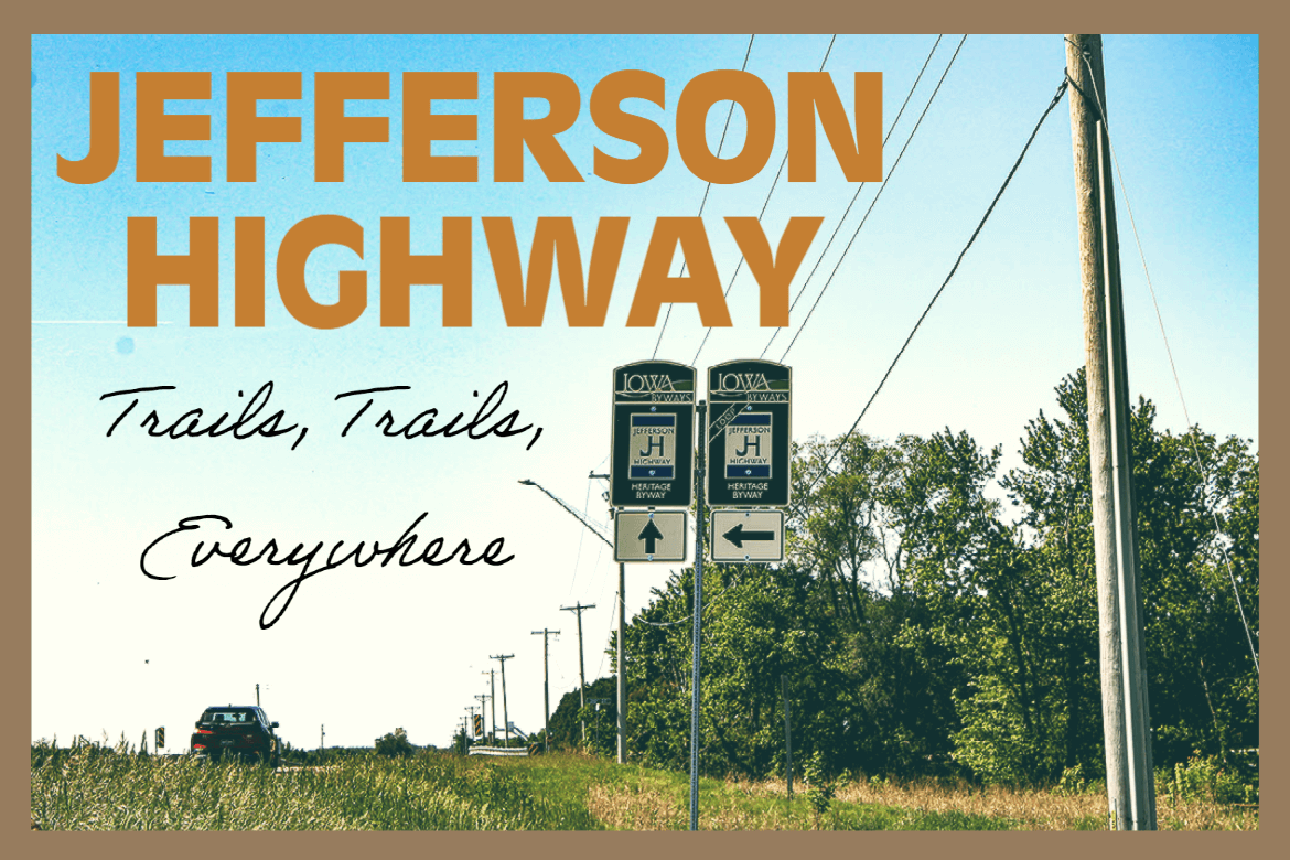
This blog series explores the historic Jefferson Highway Heritage Byway and its connection to Mason City, Iowa.
Trails, Trails, Everywhere
The beginning of the Interstate Trail
Hundreds of trails bisected the United States and stretched into Canada by the 1890s. Some were simply overgrown pathways left behind by the Native Americans that had traversed the land. Some were a testament to battles and wars that had already been fought in the United States.
Charles and Frank Duryea built the first (working) American automobile in 1893, and founded the first auto manufacturers, the Duryea Motor Wagon Company.
Thoughts of a transcontinental highway were entering into America’s stream of consciousness.
The ideal for such a highway was very forward-thinking at this time. But the wheels of change were beginning to spin very quickly.
By 1908 Henry Ford began rolling out his Model T – the first vehicle mass produced on an assembly line. Now that automobiles were affordable for the working folk, vehicle registrations sky rocketed.
By 1925 the number of vehicles registered in the U.S. was over 17 million.
Auto Trails Begin to Emerge
Automobile owners were now clamoring for good roads and they were tired of waiting for the federal or state governments to begin the job of road building. This frustration ushered in the era of named highways, sponsored by auto trail associations.
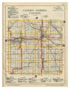
Many states had their own auto trails that existed only within the state or connected two or more states together. Cerro Gordo County alone boasts 11 trails, with at least five that pass right through Mason City.
Some of these more well-known east to west auto trails include the Atlantic-Yellowstone-Pacific (AYP) and Pershing Way, now U.S. Highway 18. Trails running north to south included the Glacier Trail and the international Jefferson Highway, both becoming part of U.S. Highway 65.
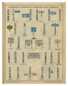
Trails were established by auto club associations, businesses, and local governments as a way to promote the towns and businesses along their route. Each association chose their own symbol and color combination for signage and worked to improve their trails.
When the registration process ended in 1925, there were 64 registered trails. The 1912 Huebinger’s Automobile and Good Road Atlas of Iowa, however, listed over 150 non-registered routes.
Interstate Trail Formed as Military Route
The Interstate Trail (IT) Association, also known as The Des Moines – Kansas City – St. Joseph Interstate Trail Association, was organized in Lamoni, Iowa on March 14, 1911. W. A. Hopkins, an ardent Good Roads enthusiast, was the founder and association president for all five years of the route’s existence.
The route was specifically chosen to be a direct route between Fort Des Moines in Iowa and Fort Leavenworth in Kansas, making it a practical military road for transportation of troops and supplies and …”a valuable aid in developing the resources of the counties traversed, a better means of social and business communication, and a lasting benefit to the communities through which it passes…,” Hopkins said.
Shortly after organizing the road was located and marked by IT association members. Excited by the thought of an auto trail going through their town, automobile clubs, commercial organizations, farmers and citizens aided their efforts.
Mason City Public Library Archives
With thoughts of expanding the route Hopkins enlisted Hugh H. Shepard, a Mason City lawyer in 1914. Through Shepard’s efforts the trail was extended north from Des Moines through Mason City and Northwood. It continued through the Minnesota cities of Albert Lea, Owatonna, Faribault, Northfield, and ended in St. Paul. It also directly lined up with another military post – Fort Snelling in Minnesota.
Shepard, selected as general manager of the trail’s northern division, took on the responsibility for marking the 271-mile trail section. He also wasted no time in securing maps and detailed guide book information about the highway from Des Moines north to the Minnesota state line.
IT Offered In Whole To Jefferson Highway
Less than a year later, when the Jefferson Highway association was formed, promoting the first north-south international highway, IT organizers were ready and willing to offer up to them more than 500 miles of “thoroughly well-marked and well-organized” trail.
The Interstate Trail, the longest section of highway between Minneapolis and Kansas City, would now serve as the backbone for the Jefferson Highway.
In honor of the Interstate Trail’s beginning as a military route, the Jefferson Highway Association noted in an April 1925 letter, “…that because the Jefferson Highway was significant militarily with the Mississippi Valley, it had been designated the ‘North-South Gold Star Highway’ in Iowa.”
Just a few years prior, the Lincoln Highway, America’s first east-west transcontinental highway had been established. The highway started in San Francisco, California, ran across the country through Iowa and ended in New York City, New York.
It is no wonder the Iowa State Highway Commission later used the term “Crossroads of the Nation” when planning its roads.
It might have been luck that everything fell into place so neatly for the IT association. Or, it might be because its organizers were always looking to, and planning for, the future.
Original Interstate Trail Marker Found
A remnant of the short-lived, but strategically important, Interstate Trail was found in 1956 on a farm two miles northwest of Hampton.
Howard Muhlenbruch discovered the original Interstate Trail marker when his rake hit a piece of metal while he was cleaning up a farm grove.
Muhlenbruch’s daughter, Kathy Hotchkiss, shared the story with the Mason City Globe Gazette in October 1995 and with the Iowa DOT in June 2007.
“He unearthed a sign that said ‘Interstate Trail.’ We had the sign on the farm for a long time, and I think my dad had nailed it to a tree,” Hotchkiss said.
After seeing the sign, A history-loving neighbor helped Muhlenbruch determine where the sign might have come from. Hotchkiss said, “We think that it probably was posted at the corner, east of our farm, and due to it getting lost or buried, (it’s) possible (it) was missed when they collected old metal for the war effort, the period when other signs disappeared.”
The Muhlenbruch farm, in section 17 of Mott Township, was located one mile west of U.S. 65, northwest of the intersection of county roads S-43 and C-31.
Hotchkiss said she believed the old Interstate Trail meandered through Franklin and Cerro Gordo Counties. “I think the trail went through Chapin, Sheffield, and Rockwell, north of Hampton, as there used to be a curve into town on the northwest side,” she told the DOT.
Eventually Muhenbruch’s discovery was donated to the Franklin County Historical Society and is still on display at the society’s museum on the Franklin County fairgrounds.
Next time- The rise and fall of the Jefferson Highway.